Our technology-driven operations and specialized services enable our clients to focus on their core competencies, consequently extracting optimum value from operations by eliminating time-consuming and resource-heavy support services such as procurement, manpower supply and consultancy services.
Our Services
Procurement Services
Our services help clients optimize their performance and profitability through process improvement, market research, implementation of Strategic Sourcing and procurement consulting services.
Aerix has built a stable procurement and supplier management best practices and price points. With its dedicated, diverse staff of actual employees (not subcontractors); Aerix provides the experience and rresources in areas such as Strategic Sourcing, Procurement Transformation, Information Technology, e-sourcing, Project Management, Negotiation, Category Management, Supplier Management, Logistics, Inventory Management, Spend Management and Strategic Planning.
Focus;
Strategic Sourcing & Category Management
Supplier Relationship Management
Procurement Audits & Compliance
Supplier Identification
Spend Analysis
Contingency Based Cost Reduction
Market Assessments & Benchmarking
Our innovative workforce solutions, connects human potential to the power of business. We serve both large and small organizations across all industry sectors.
With global insight and local expertise, Aerix partners with clients to accelerate their business by providing the people and services that raise the quality, productivity and efficiency of their total workforce, including recruitment and assessment, training and development, workforce consulting, outsourcing and career management.
Manpower Services
Managed Service Provider
Our managed Service Provider delivers solutions that optimize the management of contingent workforces, providing visibility, predictability, and performance you can count on.
Talent Based Outsourcing
We provide talent-driven outsourcing of operations, functions and services to drive the productivity you need to succeed.
Recruitment Process Outsourcing:
Our recruitment Process Outsourcing offering sources and attracts talent through our flexible and scalable recruitment solutions which can include anything from sourcing and selection to on boarding.
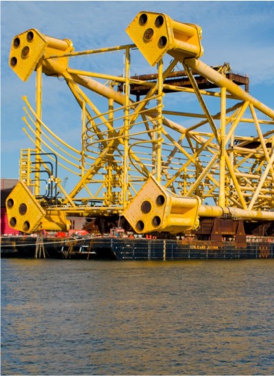
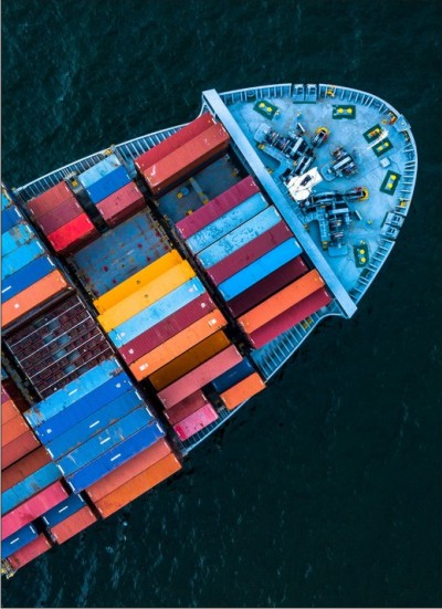
Marine Support Services
Aerix provides reliable, safe and efficient marine services and integrated solutions to the offshore energy sector in Africa. With a fleet of modern vessels, ROV’S and experienced crews, Aerix brings more than hands-on marine experience in performing complex operations at sea. Our capabilities are supported by our proven technical and commercial expertise, specialist industry knowledge and a global network.
Geophysical & Geotechnical Services
Aerix offers a wide range of geophysical, hydrographic, geotechnical, environmental and positioning data collection services. Clients benefit from our experienced staff, state-of-the-art equipment and wide range of service vessels.
Our expertise is in planning and implementing multi discipline surveys in inland, estuarine, coastal and offshore environments. We support design engineers, environmental consultants, numerical modelers, regulatory agencies, and project owners. Our strenght is the ability and willingness to provide our clients with a turnkey service, anywhere required. Aerix involvement often starts at the planning/permitting stages and, depending on the project type, runs through the desk top study, field acquisition, delivery of reports and high quality marine cadastre data, construction monitoring and ongoing maintenance and inspection phases. This capability is critical to insure accountability, proper data integration and cross checking throughout a project’s life cycle.
Perhaps you have questions or just plain curious! We’d like to have a chat. We are all about value, and it starts with the little insights our team is excited to share.